ST. GEORGE — The National Weather Service and Utah Department of Transportation are forecasting storm weather that will largely affect roads and travel Monday with lingering ice and slick conditions Tuesday morning.

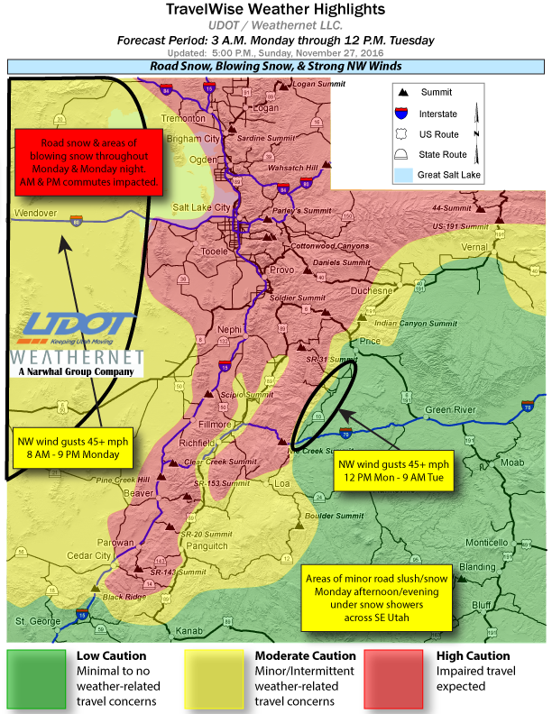
A strong winter storm is developing across Utah Monday first expanding across northern Utah and then moving through west-central and southwest Utah, including the Sanpete and Sevier valleys, by midmorning to late morning.
Snow and wind
The weather service Monday morning advisory anticipates 1-4 inches of snow with greater accumulations possible locally from Fillmore to the Scipio summit.
UDOT anticipates widespread snow and road snow and slush continuing through the day with snow heaviest on mountain routes, but valley road slush and snow impacting Monday morning and evening commutes.
Snow showers will gradually decrease from the north to south of the state, concentrating on the Interstate-15 corridor Monday evening. Ice and slick roads are likely through Tuesday morning.
West to northwest winds with gusts up to 50 mph are expected through Tuesday morning across the west desert areas.
Roads affected
Winter driving conditions are expected Monday across the affected areas, including I-15, Interstate 70 and Highway 89. Strong winds may cause blowing and drifting snow in some areas, primarily in the mountains.
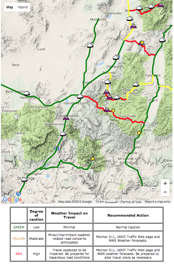
Early Monday, Utah Department of Transportation shows three highways in central-Southern Utah with hazardous conditions: State Route 14 from Cedar City to U.S. 89, state Route 143 from Brian Head east through Dixie National Forest and state Route 20 from I-15 east to U.S. 89. Other roads in the area may be affected as well.
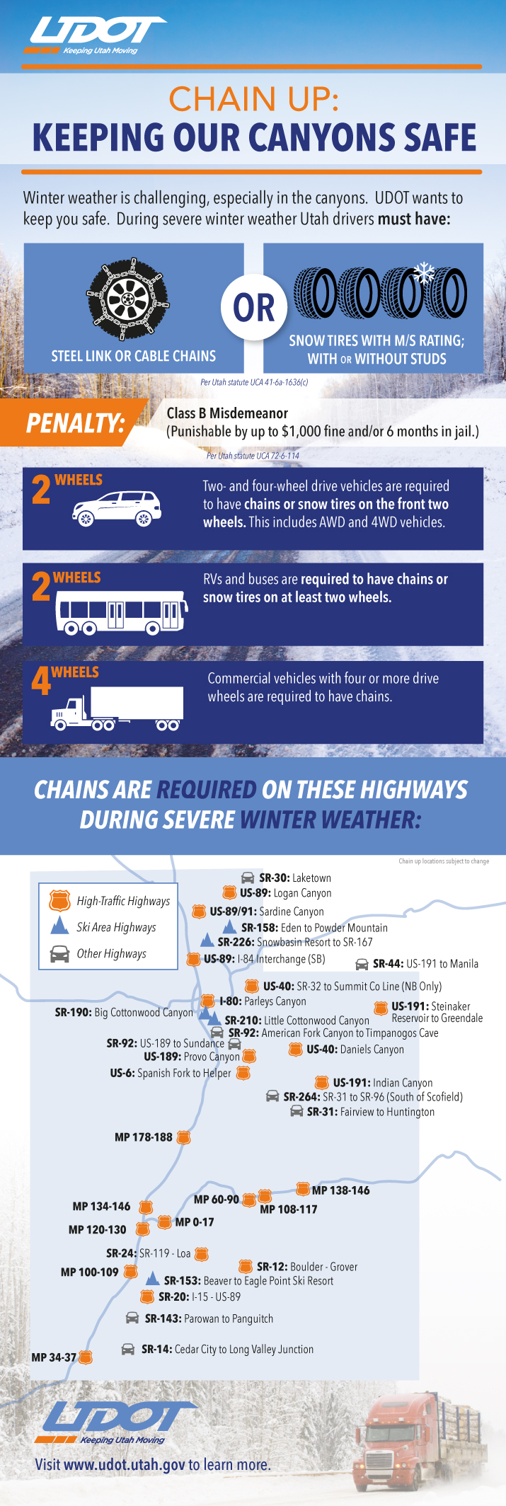
In the north, chains or four-wheel drive are required for travel in Big and Little Cottonwood canyons in Salt Lake County.
In the south, snow tires, chains or four-wheel-drive are advised for travel on state Route 143 from Parowan to Brian Head and from Brian Head to Mammoth Creek Road.
Across the state, UDOT foresees travel concerns on the routes listed below; for more specific information on roads and highways see UDOT’s road weather alert webpage.
- I-15, Idaho border through the Black Ridge, milepost 42.
- I-80, entire route.
- I-70, Cove Fort at I-15 to Fremont Junction, state Route 10
- I-84, entire route.
- I-215, entire loop.
- U.S. 89, entire route north of Kanab.
- U.S. 40, entire route.
- U.S. 191, Vernal to the Wyoming border; Indian Canyon.
- U.S. 6, Nevada border through Helper.
- U.S. 18, entire route.
Prepare and take precautions
Now is a good time to stock vehicles with a number of items that can make the difference between death and survival in the event of getting stuck in the snow. See St. George News checklist, previously published, here: Stocking your vehicle for winter; what to do in case of emergency, checklist.
Read more: What to do if you’re stuck in snow, safety kit list
Download this printable PDF: Vehicle Preparation and Safety Precautions for Winter Weather – this is a project the whole family could participate in – make it a scavenger hunt with potentially lifesaving benefits.
Utah law requires vehicles to have either steel link or cable chains or snow tires when driving roads in winter conditions October through March. Utah Department of Transportation’s infographic with particulars follows below.
Email: [email protected]
Twitter: @STGnews
Copyright St. George News, SaintGeorgeUtah.com LLC, 2016, all rights reserved.
Be aware of the changing weather alerts and be careful out there people. give yourself plenty of time to get to your destination. slow down and be prepared for the worst just in case.
wow Dump! they should hire u on as a weatherman or an emergency services expert since u know it all. Just think, a real job!